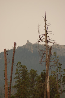
The day was overcast and sun was red. The area has been blanketed in haze from the wildfires burning throughout the northwest. Weather reports indicated that the haze is the primary cause for the drop in temperatures making this a great day for a hike.
One reason we wanted to hike this trail is that being of German heritage we are both fairly goal oriented. After an initial hike through trees you catch a glimpse of your goal and from this point you will see the lookout point fairly regularly. We talked briefly with two backpackers heading out from 3 days in the Black Elk wilderness and they said it had been an amazing experience.
We took a break at the top sign which taunts you with a reminder that you have only covered one and a half miles of distance to the summit. Willow Creek and Harney Peak only give you trail numbers nothing about distance. For those who aren't from this region, Harney Peak is the old name for Black Elk Peak. Not all signs have been changed.
Break time over we are headed on the trail. Neither Vick nor I are particularly fond of having our pictures taken so I snapped this one of her on the trail.
Elkhorn Mountain is the background peak on the right. We aren't to the half way point of our hike up.
We decided to take a break at the unusual pile of rocks in the top picture. It was 10:30, sun had broken through the haze and we had been on the trail for 3 hours. Our goal is definitely getting closer.
Just as we were nearing the final turn to climb to the lookout, we met two retired teachers from Boston who had missed the turn. We guided them back a couple of hundred yards to the proper turning point and they were off to the summit. It seems that the eastern U.S. uses the term, "overlook," for a scenic spot on the trail while this part of the country (this trail anyway) uses the term, "overlook" to mean, this way to the summit. We arrived at the summit at 12:00. Nearly everyone else at the summit had followed the trail from Sylvan Lake.
These two pictures are from the summit of Black Elk Peak. Top picture has a view of part of the trail Vicki and I hiked while the lower picture shows Little Devil's Tower (complete with people on top). We decided to head back down at 12:15 having hiked around the summit the week before. There is a lot to see once you arrive on top so don't think this is just an up and down trip. We met a hiker who makes this trip weekly during the good weather times of year. She isn't young but is well prepared with all the gear necessary to make this a comfortable hike.
My apologies for not having a better telephoto lens, the upper picture has two mountain goats relaxing on a hillside. The lower picture is the backside of Mt. Rushmore. At this point Vicki injured her knee and we have a long way to go before we rest. God was good and kept Vick healthy enough, strong enough, stubborn enough to make the painful trip back. It was slow but she persevered in overcoming an old knee injury that likes to reappear on downhill treks in mountains. We did pass another backpacker on the trip down who was on his third day out in the wilderness. We also met two people on beautiful horses headed up the trail. We did think it would be helpful if they caught us on the their downhill trip and offered Vick a ride but that didn't happen. We did safely make it back down and got ice on Vick's knee as soon as we were back home. A long and tiring day but the beauty of this area is always uplifting even on a hazy day.


No comments:
Post a Comment